Riverbend Park Open
Notice: February 12, 2025- Riverbend Park has been re-opened with limited access.
Many trails and/or paths along the river and through disc golf courses are still flooded and inaccessible. River flows are still high and may change quickly, with little notice. Waters are cold and moving quickly, please stay out of, and away from, moving waters.
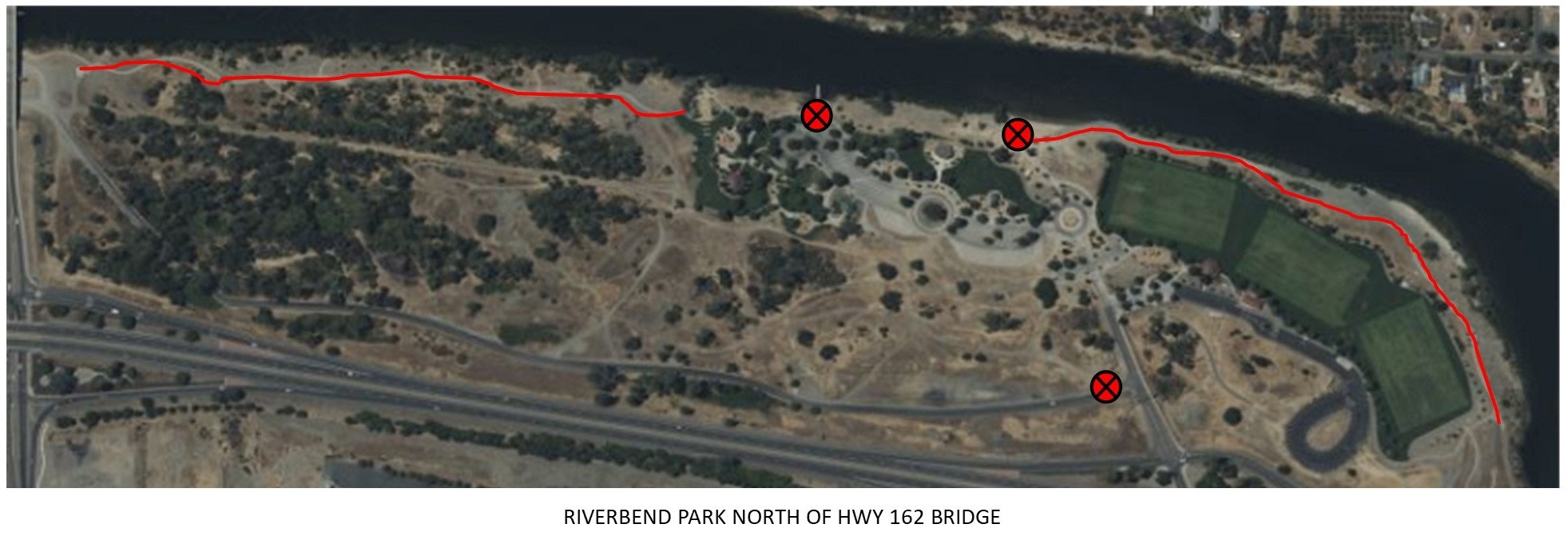
CLOSED AREAS – Please adhere to all closed area signs. See maps below.
- Riverfront trail from beach to Hwy 70 bridge near soccer fields
- Riverfront trail from boat launch to Hwy 162 bridge
- Beach and Beach Picnic Areas
- Boat Launch
- Salmon Run Road
- Dog Park / Pond Parking area and Restroom
- Pond Picnic Areas
.jpg?ixlib=rb-1.1.0&w=2000&h=2000&fit=max&or=0&s=cc4a2f5eb14dd1fe115cc2ce199d63b7)
.jpg?ixlib=rb-1.1.0&w=2000&h=2000&fit=max&or=0&s=da1f0f1fc09d5bdc54ab10ed915be2f6)
.jpg?ixlib=rb-1.1.0&w=2000&h=2000&fit=max&or=0&s=65c16d9e4a81f08e7762731560306783)
.jpg?ixlib=rb-1.1.0&w=2000&h=2000&fit=max&or=0&s=3d8882c9e15856a21d190add9426579f)
.jpg?ixlib=rb-1.1.0&w=2000&h=2000&fit=max&or=0&s=54ed243073ba8021551d6520fa28ba51)